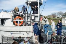
There is no purer pleasure for anglers on Martha’s Vineyard than the tug on the line of the first striped bass of the season. That first hit in early May or June renews a seasonal relationship that is as old as the Island itself.
Climate Action Week, with its nearly 40 free events culminating in a finale Saturday at the Grange Hall in West Tisbury, has kept Vineyarders informed and inspired.
Gusty winds blew across the Atlantic ocean Tuesday evening when some 20 Islanders gathered at the left fork of South Beach. A newly restored dune about 14 feet high obscured any view of the ocean from the road.
Climate Action Week, a series of events put on by the Martha’s Vineyard Commission, looks to engage Islanders in planning for the effects of climate change.
The changing shoreline on Martha's Vineyard variously fascinates, startles or horrifies people, depending on where they live or own property. The strongest supporting images of erosion are provided by destruction of buildings located at the water's edge, such as lighthouses and Worlds War II military bunkers. Among the latter, a concrete bunker (part of the Katama Naval Air Station target track) once 180 feet from the shore at South Beach in Edgartown was last seen far offshore, drowned in the surf. The associated rate of shoreline retreat comes to about 12 feet per year.
A startling new national report that uses computer imaging to flag the effects of global warming on the Massachusetts coast shows that the south shore of the Vineyard will be washed away and downtown Edgartown will be a swamp in 50 years — even if the most conservative projections about rising sea levels are correct.
The report was issued yesterday by the National Environmental Trust (NET), a nonprofit, nonpartisan group based in Washington, D.C.